Showing posts with label geology. Show all posts

Thursday, 7 June 2018

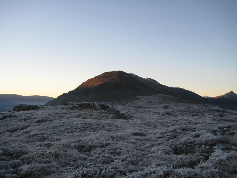
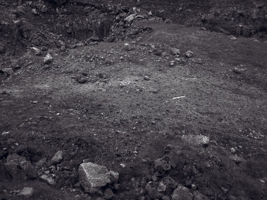
below, the rocks plunged into darkness (documentation)


Some documentation of my current show at the Studio Pavilion, House for an Art Lover, Glasgow. The show continues until July 15th, 2018


Below, the rocks plunged into darkness

still from "a darkening" super 16mm digital film, 4'33"
Here's a link to my current exhibition at the studio pavilion at the house for an art lover.
https://www.houseforanartlover.co.uk/arts/exhibitions-projects/studio-pavilion-exhibiton


Wednesday, 30 August 2017

Friday, 12 June 2015

liath, dearg, dubh.

Pieces of grey, red and black granite found very close to each other by a stream that flows into Loch Ossian, from the slopes of Carn Dearg, whilst making an anti-clockwise walk of the loch in bad weather, March 2015

weight

A rock found in the abandoned lead mines at Strontian, containing intrusions of galena, July 2014. Strontiante was first discovered here in 1790 and it's from this mineral that the element Strontium was first isolated. Galena is sometimes known as "lead glance", and is an important source of silver.

flake

Quartz interspersed with sheets of flaking mica, found amongst the rubble of a dis-used steading in the Cairngorms,  Sept. 2014

strata

Quartzite banded rock found beside the coral beach, at Coillegillie, Applecross, close to a plaque with the inscription "Greig Lerner loved this place",  April 2015

Monday, 4 August 2014

studio table top

hydrangeas from my folks' garden
various found stones (galena, pyrites, quartz, gabbro)

Sunday, 15 July 2012

living deep time

I visited the Fossil Grove in Victoria Park in Glasgow today for the first time. This is an amazing gem in Glasgow's museums, and one that is so often overlooked. The Fossil Grove consists of the cast remains of the stumps and roots of a group of fossilized trees which were revealed in 1887 during excavations when the park was being created to mark Queen Victoria's golden jubilee. Quarrying for dolerite, the workers quickly realised the sandstone casts were of great scientific significance, and the city ensured the grove was protected by a custom made building, one of the first to protect a geological site of special interest.

The Fossil grove when it was first excavated in 1887, before it was protected by it's building.

Schoolchildren visiting the grove in the 1948

"There are at least 10 erect trunks and root systems exposed of the clubmoss tree Lepidodendron veltheimianum and Stigmaria ficoides (the latter being the roots of the former).  There are also parts of trunks lying across the floor of the quarry.  The trees were submerged in sand and clay as sea level changed.  Rippled sands, similar to those found on the lower reaches of present-day beaches, provides evidence of water currents moving between the trunks depositing sediment.  The trees grew in an equatorial or tropical mangrove swamp similar to the everglades of Florida. 

After the clubmoss trees had died, their soft interiors quickly rotted to leave them hollow.  Their trunks then filled with sand before the sediment around them enclosed them completely.  The organic remains of the trunk became a thin coal separating the sandy interior from the shales and sands surrounding the trunks.  During an episode of volcanic activity, a thin dolerite sill was intruded about 90cm above the floor of the quarry cutting through the trunks.  Some slight earth movements have caused the sediments (and the trunks) to tilt slightly, sloping gently towards the NE, but the slight distortion of the trunks themselves are likely to be due to palaeocurrents rather than tectonism (Gastaldo 1986)."


We arrived early in the day, the first visitors, and, with no-one other than a very helpful guide present, were surprised by the intense, quiet presence of these old petrified remains. I was relieved to see that the video projector wasn't working, and instead benefitted from a display that held a quiet kind of dignity that museums sometimes don't allow it's artifacts these days, pressured as they are to make all things 'accessible'


These special trees had lain quietly for around 330 million years, and the quiet atmosphere of the fossil grove got me thinking about deep time and how, when looking at rock, one readily accepts, even if one fails to fully comprehend, time beyond human understanding. Faced with recognisable objects that were clearly, at one point, huge living organisms, these 'understandings' of deep time became even less robust - or rather, confused - for me.  How can some things so very, very old, things that have witnessed numerous ice ages, that pre-date the dinosaurs, that existed on equatorial land (these are tropical trees which grew when the land that Glasgow sits on was located at the equator) and have journeyed northwards by continental drift bearing witness to the supercontinent of Pangaea's split; how can things this old look, well, ...so commonplace? They don't match my understanding of the  deep time of geology as regularly encountered in rocky mountainous landscapes. The amorphous shifting, sliding, bulging and intrusion of rock formations that can be so clearly seen in Assynt for instance, Scotland's mecca for students of geology, and where the Moine thrust can be clearly viewed from the roadside, is fantastical and mind boggling. But the simple silence of these trees weathering ages and eras, and remaining relatively intact seems to me to be something quite different altogether.

photo: L Punton

Interestingly, our guide informed us that despite finding such large specimens of trees found preserved in situ, the space around them giving us information as to the density of trees that would ordinarily be found in the full extent of this woodland site, no other living specimens were found. No insects, no other plant life, in land that would have been lush with other life-forms. It's still not really known why this should be the case. The day before, I'd read of the Fortingall Yew, a yew tree in Glen Lyon that is believed to be the oldest living organism in Europe. Yew trees can't really be dated like other trees, since the interior wood naturally rots and decays,  eventually leaving a hollow interior  whilst the exterior lives and grows. The decay of the heartwood has created the illusion of more than one tree, but it's measurement in 1769 put it at around 52ft in breadth, and the Fortingall Yew is believed to be somewhere between 5-10 thousand years old. In human terms, even this is a timescale difficult to truly negotiate and place oneself within. But the yew's resistance to dating because of it's hollow core means it doesn't fully yield to measurement, to being quantified. The Lepidodendron trees of the fossil grove have been preserved precisely because of their similarly hollowed interiors, yet they too resist and retain their quiet mystery precisely because they are old way beyond our ken.

The fossil grove as it is today. Photo: L Punton.
The fossil grove when it had a curved platform running through it's length


Saturday, 5 March 2011

palimpsest

manuscript of text from Louis Agassiz
To appreciate it's beauty, this image from the archives really warrants zooming into. See also previous post on the work of Agassiz.

Friday, 4 March 2011

the parallel roads of glen roy


A picnic near the Zermatt Glacier
Louis Agassiz, from Etudes sur les glaciers, 1840
I recently learnt of the work of Louis Agassiz, the Swiss paleontologist, glaciologist and geologist and occasional artist. Agassis was an important figure in describing the movements and motions of glaciers, and whilst it was understood that much of our landscape is formed through glaciation, that ice had the power to shape the land, move vast boulders great distances and to grind down rock, he was the first to propose that the earth had recently undergone an ice age, and that vast tracts of land in europe had, in gelogical time, recently been covered with ice.

Hugi's hut on a medial moraine of the lower Aar glacier
Louis Agassiz, Etudes sur les glaciers, 1840
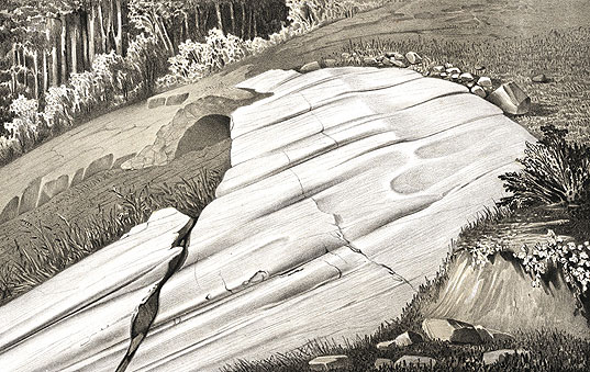
Rocks polished and striated by a glacier
Louis Agassiz, from Etudes sur les glaciers, 1840
One of his more significant discoveries was made in Scotland when Agassiz finally unlocked the mystery of the parallel roads of Glen Roy when he proposed that the "roads" were not of a marine nature, as was erroneously proposed by Darwin, but were in fact caused by the rapid damming by a glacier of a loch in the period of the Loch Lomond stadial (a mini ice age around 12000 years ago, and lasting for a brief 600 years) and it's subsequent melting, in three stages.

the parallel roads of Glen Roy
I've spent much time walking and camping during winter in Glen Roy and have a favourite wild camp spot near Fersit. It's amazing to think that in the relatively recent past, this familiar valley would have been hidden under water, and my wild camp buried under a glacier near the head of Loch Trieg. I've seen the parallel roads marked on the Ordnance Survey maps, always rather assuming that they were indeed "roads", perhaps forestry tracks or some system of roads where a higher track existed to avoid boggy ground, but of course, that would eliminate the need for the lower tracks. Instead, they are completely natural, and lie on the horizontal, mapping, marking and measuring dramatic moments in the valley's past where the ice dams spectacularly broke and the glacial loch drained.

Stob Coire Easain (near Fersit), Dec 19th 2007

Sunday, 13 February 2011

Celmins - to fix in the memory

Vija Celmins - To fix in the memory, 1977 - 82
(stones paired with identical painted bronze copies)

Sunday, 5 December 2010

born mountaineers


Research by Geoffrey King and Geoff Bailey in the new scientist suggests that humans are ideally suited to mountainous terrain. As a species we're unable to run fast, so wide open plains are not conducive to the survival of humans. But by inhabiting irregular terrain such as mountains and valleys with our ability to scramble and clamber, human beings holds a definite advantage. "Humans are adapted for complex topography" says King. Research also holds that we have tended to cluster around rougher tectonically active landscapes. When Bailey and King superimposed the locations of human fossil sites throughout Africa with satellite images that show the roughness of the land, they found that they lined up neatly.


Saturday, 24 July 2010

revisiting Strontian

Some years ago, I made a series of black and white images on 5x4 polaroid of the lead mines by Strontian in Lochaber, Scotland. Initially inspired by a desire to revisit a place from childhood that I felt was like the surface of the moon, I went back and, unusually, wasn't disappointed by the emotions it generated. The place was, indeed, just as I remembered it, and my childhood recollections somehow remained intact. (Re-visitation is often a disappointment, and something I think I normally approach with caution). The images were from a wider series where I was interested in this idea of recreating or finding a space to act as a surrogate for the lunar landscape, a place both barren yet beautiful, and I made images in quarries, others at the base of the chalk cliffs at Beachy Head on the south coast of England, more still in Swedish Lappland, and finally, in the old lead mines of Strontian.
Strontian, July 2010

It's a curious thing to go to Strontian and try to find out more about the history of the mines, and of the place where the element Strontium was discovered. Considering the element was named after the village, they tend not to make much of this fact. The tourist information office "used to have some leaflets, but they're out of print now".
Strontium was recognized as distinct from barium in 1790 by Adair Crawford in a mineral sample from one of the lead mines  and the metal first isolated by Sir Humphry Davy in 1808. I was always aware of this metallic quality to the ground there, mainly through my memories of hunting for bits of lead in the rocks strewn around these predominantly opencast mines (though a number of deep shafts are still visible and dangerous), and this idea of a magnetic, or chemical "pull" always fascinated me.
So on our recent trip north, I decided to show Jim the location where I originally made these photographs. Last time I was here (it must have been around 1997/8), I carried a 5x4 camera, heavy duty tripod, double dark slides and ordinary 5x4 film, dark cloth, changing bag, polaroid type 55 film and holder, a clearing bucket containing in the region of 1 litre of sodium sulphite solution (I was living in London at the time and had come a long way, so wanted to see the results there and then) as well as the usual walking gear/paraphenalia. This time we had a small digital camera.
I easily found the locations of some of the original images, and together Jim and I recreated those images loosely from memory. The originals are large scale silver gelatin prints, so I need to find them to re-photograph them, but in the meantime, this post shows two of those images made last week.
 Strontian, July 2010

Tuesday, 13 July 2010

different timelines


I visited the small island of Staffa, (from the Old Norse for stave, or pillar island) off the west coast of Scotland yesterday, catching a small boat from the Isle of Mull. With only a relatively short time on the island, our two main aims were to walk down to Fingal’s cave and then walk to the other end of the island in the hope of seeing some puffins.


The remarkable geological formations on Staffa are justifiably renowned, having inspired artists, writers and musicians over the years, with Felix Mendelssohn’s Hebrides Overture perhaps being the most famous work made in it’s honour. Others that have visited and found inspiration are Turner, August Strindberg, and Sir Walter Scott.

It’s great to find an important heritage site in the UK which you can freely enter without health & safety regulations compromising the experience, and walk right to the very back of the cave. Inside, a deep booming can be heard as the sound of the sea dramatically crashes at the cave end, resonating and echoing throughout.


Staffa is a relative lightweight in terms of Geological age – a mere 55-58 million years compared to it’s aged neighbour Iona which weighs in at a hefty 2800 million years (composed, as it is, of Lewisian gneiss with Torridonian sandstone), and Staffa’s dramatic forms are created from volcanic basalt which appears to thrust from the sea in regular columns that are predominantly hexagonal in shape. There are three layers of rock: the base is composed of tuff, the second layer is columnar basalt, and the top, which forms the roof of Fingal’s cave is amorphous basalt. In the columnar layer, the cooling surface of the mass of hot lava cracked in a hexagonal pattern in a similar way to how drying mud cracks as it shrinks, and these cracks gradually extended down into the mass of lava as it cooled and shrank to form the columns, which were subsequently exposed by erosion.


Once we viewed the cave, we headed up to the other end of the island to see if we might catch a glimpse of some puffins. An extraordinary thing happened. I sat down on the cliff edge and within 15-20 seconds, a puffin flew straight towards me and landed in a hole around three feet from where I was sitting. In its beak were a couple of tiny sand eels, and after a minute in the hole, it flew out to, presumably, catch more food. Needless to say, the swiftness of the experience meant that I didn’t catch it on camera – but then on this instance a camera would have impinged upon the experience itself. Some things are more precious because of their fleetingness.