![]() |
| Thomas A Clark, 2011 |
Tuesday, 17 May 2011
the mountains of Holland base camp
Tuesday, 10 May 2011
the fram
![]() |
| Blankets from the cabin of The Fram. L Punton 2006/2011 |
Friday, 29 April 2011
Monday, 25 April 2011
a walk to Loch Ternait
Back again at Ardtornish in Morvern, we took a walk to Loch Ternait and Leacraithnaich Bothy. Jim and I last walked here 9 months ago, just 7 weeks before Angus was born, a time when we visited Staffa, and revisited the lead mines of Strontian a place where I'd made work many years ago.
Ternait too, is a place of memories from my childhood, though the bulldozed track that easily leads to the loch is a rather brutal scar on the land. But with the work that's happened in connection with the hydro scheme (damming past the outflow of the loch and diverting water through a pipeline) mud and silt has been dredged up on the track that has made the passage of wind on the surface water behave in an extraordinary way. Jim and I documented it on my digital camera, and this is the result.
In the middle of the loch lies a tiny crannog that used to house a shelter.
"Those accused of crimes from Lismore or Mull or neighbouring places, if they got permission from the Chief of Ardtornish to reside forty-eight hours on the island, were free from any liability to punishment. The island was thus a sanctuary – hence name Tearnait or Tearnaech Inaid, “place of safety”."
The crannog can be seen towards the left of the image above (once zoomed in) as a greenish patch on the loch. Another place of safety, the tranquility of the well maintained bothy seems to be constantly under threat from the forces of commerce, with the massive Glensanda Superquarry just visible from it's door. Still, it's a great spot, with summer water levels revealing sandy beaches around the fringes of the loch. It remains to be seen how the water levels will alter in future though once the hydro scheme is completed, and whether the beaches and indeed the crannog may be lost.
Ternait too, is a place of memories from my childhood, though the bulldozed track that easily leads to the loch is a rather brutal scar on the land. But with the work that's happened in connection with the hydro scheme (damming past the outflow of the loch and diverting water through a pipeline) mud and silt has been dredged up on the track that has made the passage of wind on the surface water behave in an extraordinary way. Jim and I documented it on my digital camera, and this is the result.
In the middle of the loch lies a tiny crannog that used to house a shelter.
"Those accused of crimes from Lismore or Mull or neighbouring places, if they got permission from the Chief of Ardtornish to reside forty-eight hours on the island, were free from any liability to punishment. The island was thus a sanctuary – hence name Tearnait or Tearnaech Inaid, “place of safety”."
![]() |
| Loch Ternait from Leacraithnaich Bothy |
![]() |
| Map of Loch Ternait showing the crannog. Leacraithnaich lies on the West side of the loch. |
![]() |
| Leacraithnaich bothy interior |
the real death star
![]() |
| Mimas, photographed by the probe Cassini |
![]() |
| Herschel crater |
Thursday, 14 April 2011
rough sea
A great image from some landscapes in a recent post on Susan Hiller's dedicated to the unknown artists of 1972-76.
![]() |
| Fred C. Palmer of Tower Studio, Herne Bay, postcard, 1913 |
Friday, 1 April 2011
rime frost
![]() |
| the chairlift today, in Glencoe, courtesy of the SAIS. |
...postscript: it was an April fools prank.
Tuesday, 29 March 2011
stob coire nan lochan
Saturday, 26 March 2011
Saturday, 5 March 2011
palimpsest
![]() |
| manuscript of text from Louis Agassiz |
Friday, 4 March 2011
the parallel roads of glen roy
![]() |
| A picnic near the Zermatt Glacier Louis Agassiz, from Etudes sur les glaciers, 1840 |
![]() |
| Hugi's hut on a medial moraine of the lower Aar glacier Louis Agassiz, Etudes sur les glaciers, 1840 |
![]() |
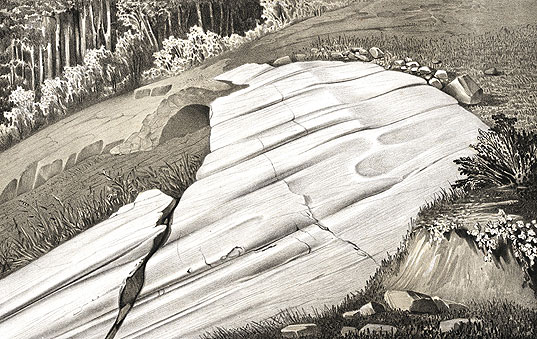
| Rocks polished and striated by a glacier Louis Agassiz, from Etudes sur les glaciers, 1840 |
One of his more significant discoveries was made in Scotland when Agassiz finally unlocked the mystery of the parallel roads of Glen Roy when he proposed that the "roads" were not of a marine nature, as was erroneously proposed by Darwin, but were in fact caused by the rapid damming by a glacier of a loch in the period of the Loch Lomond stadial (a mini ice age around 12000 years ago, and lasting for a brief 600 years) and it's subsequent melting, in three stages.
![]() |
| the parallel roads of Glen Roy |
I've spent much time walking and camping during winter in Glen Roy and have a favourite wild camp spot near Fersit. It's amazing to think that in the relatively recent past, this familiar valley would have been hidden under water, and my wild camp buried under a glacier near the head of Loch Trieg. I've seen the parallel roads marked on the Ordnance Survey maps, always rather assuming that they were indeed "roads", perhaps forestry tracks or some system of roads where a higher track existed to avoid boggy ground, but of course, that would eliminate the need for the lower tracks. Instead, they are completely natural, and lie on the horizontal, mapping, marking and measuring dramatic moments in the valley's past where the ice dams spectacularly broke and the glacial loch drained.
![]() |
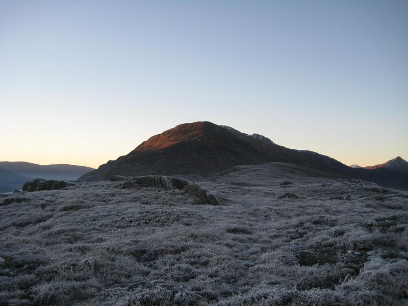
| Stob Coire Easain (near Fersit), Dec 19th 2007 |
Sunday, 13 February 2011
Saturday, 5 February 2011
Subscribe to:
Posts (Atom)